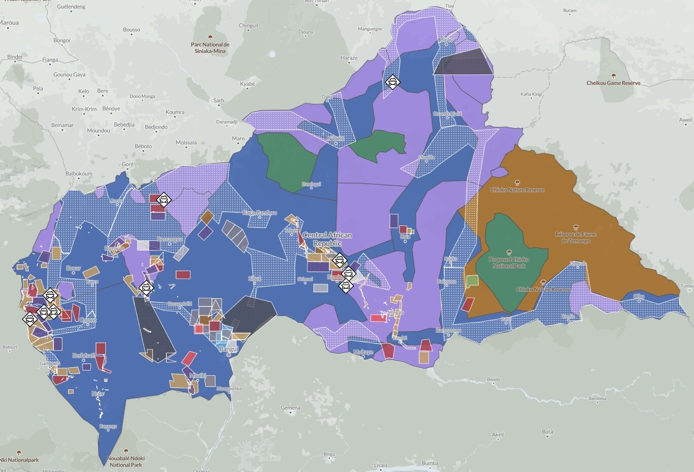
View the map
Drawing on field investigations, satellite imagery, open-source intelligence, confidential sources on the ground and government decrees disclosed through the Extractive Industries Transparency Initiative in the CAR, the map includes:
- Mineral research and exploitation permits issued by the Central African government
- Areas of strategic mining activity
- Zones vulnerable to violence
- Armed actors’ territorial influence
This platform visualizes the intersections between mining operations, armed actors, state-aligned networks and areas affected by insecurity and conflict dynamics across the CAR.